Fort Sixes, the Indian Removal, and Governor Joseph Brown

Updated: Sep 19

Nearly 190 years ago, in what is now Cherokee County, more specifically in an area near Lake Allatoona and Bridgemill, an Indian Removal fort was built in 1838. Eight years earlier, Camp Hinar was established when a Federal Lieutenant named Abram Fowler destroyed 19 buildings built by prospectors and gold miners who had illegally entered the Cherokee Territory.
The Indian Removal Act was passed in May, 1830. Dissident Cherokee Leaders (Ridge and Boudinot) met at New Echota in December, 1835, to agree upon the terms of the Cherokee removal. Army General John Wool came to New Echota to establish supply depots and forts. Fort Wool was established at New Echota as the HQ for the Indian exile.
In 1838, Fort Sixes was built. Historical records show orders for the construction of storehouses, pickets, blockhouses, ovens, hospitals, and offices, and the distribution of muskets, pistols, scabbards, swords, powder, mess pans, nails, cook pots, iron, stationery, rations, and thousands of bushels of com and bundles of fodder. Trees would have been cleared for a considerable distance and used for construction and fuel.
After Fort Sixes was constructed, five companies were deployed to the encampment - the greatest number of troops assigned to any Indian removal fort in Georgia. Mounted companies occupied the fort and necessitated the building of a stables for horses.
The five militia companies were:
•Captain John D. Stell of Fayette County (79 men)
•Captain James T. Ellis of Henry County (64 men)
•Captain Thomas H. Bowman of Elbert County (70 men)
•Captain Mathew T. Hamilton of Gwinnett County (38 men)
•Captain James Daniel of Madison County (73 men)
Total militia: 324
A total of 950 Cherokee Indians were rounded up from the area near Sixes town and sent to Fort Wool on June 9, 1838. Fort Wool was located just beyond the border of the Cherokee Capital of New Echota in what now is Gordon County.

*Sixes - according to historian Dr. John Goff, was the English translation of the Cherokee word Sutalee.

The other forts in Georgia were:
•Fort Buffington (Cherokee)
•Fort Newnan (present-day Pickens) and Fort Hetzel (Gilmer)
•Fort Floyd (Lumpkin)
•Fort Cumming (LaFayette)
•Fort Means in Cass County (present-day Bartow)
•Fort Campbell (Forsyth)
•Fort Gilmer (Murray)
•Fort Hoskins (Murray)
•Camp Scott (Floyd County)
•Cedar Town (Polk County)
•Fort Wool (Gordon County)
After leaving Fort Wool. thee Cherokee from Fort Sixes were marched into Ross's Landing in Tennessee, before making their final exodus to the Oklahoma Territory. Of the 16,000 Cherokee that were removed, 4,000 died from exposure, starvation and disease. The Cherokee believe the number of dead to be closer to 6,000.
---------
Camp Hinar Sixes (1830), and Fort Sixes (1838), were built at the Cherokee habitation at Sixes Village. Sixes Village can be seen here on John Coffey's map (1824) on both sides of the Etowah River and on the North side of the Little River.

The Cherokee Indians, as with the land of the Franklin Gold mine, had mined gold prior to the invasion of the European colonists. And likewise, as with the Cherokee located near the Franklin Gold Mine, the Indians were rounded up in a similar internment camp, likely at Fort Campbell (located near Blackburn's on the map above), before being sent by foot to Oklahoma, leaving their land, property, and country behind.

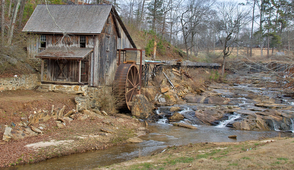
Georgia Governor Joseph Brown, born in 1821 to Mackey Brown and Sally Brown (nee Rice), purchased most of the land near the Sixes Methodist Church where his parents, close relatives, and his wife's family, the Grishams, are buried beside each other. The mill located off Highway 515 and Sixes Road in Cherokee County is Grisham's Mill.

Fort Sixes former land is under Lake Allatoona.


Great explanation!
I have actually always wondered why that exit was named Sixes. Always wondered while driving and never thought later to look it up! Thanks.